1

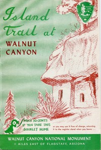
Island Trail at Walnut Canyon Walnut Canyon National Monument — Inside the Classic
(0 User reviews)
37
Project Gutenberg
2019
Not confirmed
Cliff-dwellings -- Arizona -- Walnut Canyon National Monument; Hiking -- Arizona -- Walnut Canyon National Monument; Trails -- Arizona -- Walnut Canyon National Monument -- Guidebooks; Sinagua culture -- Arizona -- Walnut Canyon National Monument; Walnut Canyon National Monument (Ariz.) -- Guidebooks
Readers of public-domain and historical texts
Project Gutenberg digital edition
en
Edition facts
Words
9,147
Reading time
40 min
Text sections
2
For Island Trail at Walnut Canyon Walnut Canyon National Monument — Inside the Classic, the stored edition analysis reports 9,147 words, 40 min estimated reading time, and 2 detected text sections.
The text analysis averages about 19.9 words per sentence, while the detected sections provide another way to judge how the source is divided.
Project Gutenberg metadata also associates the work with “Cliff-dwellings -- Arizona -- Walnut Canyon National Monument,” connecting these edition facts with the source record’s subject description.
Source:
Project Gutenberg record #59840
This editorial note examines the structure and imagery of the Island Trail guide, focusing on the movement from rim to saddle, the recurring contrast between desert and forest vegetation, and the use of numbered markers to pace the descent through Walnut Canyon.
Editorial Edition Score
4.5/5
★★★★★
★★★★★
Calculated from edition completeness, EPUB availability, text structure and catalogue metadata. Not a user rating.
How this score is calculated
- Description quality20 pts
- Title & short description10 pts
- Source metadata20 pts
- Text length15 pts
- Chapters / structure15 pts
- EPUB file integrity20 pts
Total of 100 points, scaled to a 2.5-5.0 range. Editions with an empty description or a missing EPUB file are not scored.
Edition quality
Public-domain source text
Read the source text
The source text is kept in the dedicated reader, separate from this catalogue record and its commentary.
The Island Trail guide leads readers down a 185-foot descent by ramp and stairway to the canyon floor, then around a horseshoe-shaped island past more than a hundred cliff dwellings. The booklet’s structure mirrors this physical journey: each numbered marker corresponds to a paragraph that pauses the narrative at a specific vantage point. The text moves from a broad overview of the canyon’s geology and vegetation to close-up observations of Sinagua artifacts, petroglyphs, and building materials. This alternating rhythm—wide view, then focused detail—gives the guide a steady, exploratory pace.
Descent by Ramp and Stairway
The guide begins at the observation point, where the trail drops 185 feet to the saddle. The text emphasizes the vertical movement: “a drop of 185 feet by ramp and stairway.” This descent is not merely a physical transition but a structural one. The first numbered marker offers a panoramic view of the horseshoe bend, describing the island connected by a narrow neck of land. The prose then shifts to the canyon’s vegetation, noting that the north side (southern exposure) hosts desert plants while the opposite side supports species from higher elevations. This contrast is repeated later when the guide discusses the Ponderosa Pine, Pinyon, and Juniper belt. The descent thus becomes a journey through ecological zones, each step revealing a new layer of the landscape.
Numbered Markers as Narrative Anchors
The booklet’s structure relies on numbered markers that correspond to numbered paragraphs. This system turns reading into a guided walk: visitors are instructed to “read the paragraph with the corresponding number” at each marker. The text does not flow continuously but pauses at each station, creating a series of discrete observations. For example, marker 1 provides a general view of the canyon, while later markers focus on specific ruins, petroglyphs, or plant species. This segmented format mirrors the trail’s physical stops and encourages a stop-and-look rhythm. The guide also notes the trail’s total length (five-eighths of a mile) and average time (40 minutes), reinforcing the idea that the booklet is a tool for pacing the visit.
Recurring Images of Water and Drought
Water appears as both a present absence and a past presence. The guide states that Walnut Creek was dammed in 1904 to form Lake Mary, so “otherwise there would be a running stream in the canyon today.” This observation is paired with speculation that the Sinagua chose the canyon for its water source. Later, the text discusses drought as a possible cause of abandonment, citing a 23-year drought from 1276 to 1299 A.D. and noting that the Sinagua may have built earthen dams. The imagery of water—its presence, damming, and failure—recurs throughout the guide, linking the modern visitor’s experience to the ancient inhabitants’ challenges. The petroglyph cut on the canyon walls below the island also hints at a cultural relationship with the canyon’s watercourse.
Movement Between Rim and Ruin
The guide’s structure emphasizes movement from the rim down to the ruins and back. The opening description of the trail’s descent is followed by a close examination of cliff dwellings, building materials, and artifacts. The text then shifts to broader topics: arts and crafts, trade routes, and the Sinagua’s physical resemblance to modern Hopi. This movement from specific to general mirrors the visitor’s own trajectory—from the panoramic view at the top to the intimate scale of the dwellings, then back to the wider context of regional prehistory. The guide also includes practical information about facilities and approaches, grounding the reader in the present-day monument while the archaeological sections reach into the past.
The Island Trail guide is best read as a companion to the walk itself, its numbered paragraphs matching the trail markers step for step. Readers who follow the booklet in order will experience the canyon’s geology, ecology, and human history in the sequence intended by the National Park Service. The guide’s brevity—under 10,000 words—makes it a concise field reference, but its careful structure rewards those who pause at each marker and look up from the page.
I remember pausing on the island trail, the juniper scent rising from the canyon floor, and feeling a strange kinship with places far away. That quiet patience—walking from one marker to the next—reminded me of a different kind of wandering, across a misty Scottish isle. There’s a similar stillness in A summer in Skye, Volume 1 (of 2) — Edition Insights, where every step feels both measured and unhurried.
There are no reviews for this eBook.
There are no comments for this eBook.
Reader reflection
What was your reading experience?
Capture what you thought, learned, and would like to remember.
Your progress
0
/
10
2
Did this book hold your interest?
3
Would you pass this book on to a friend?
4
How easy was the book to follow?
5
Did it raise ideas you would like to talk about?
6
How did the reading compare with what you expected?
7
How understandable was the text?
8
What was its emotional impact?
9
In one sentence, what did you learn?
10